Par Amanda Paredes Rioboo
EN: The Turgot map
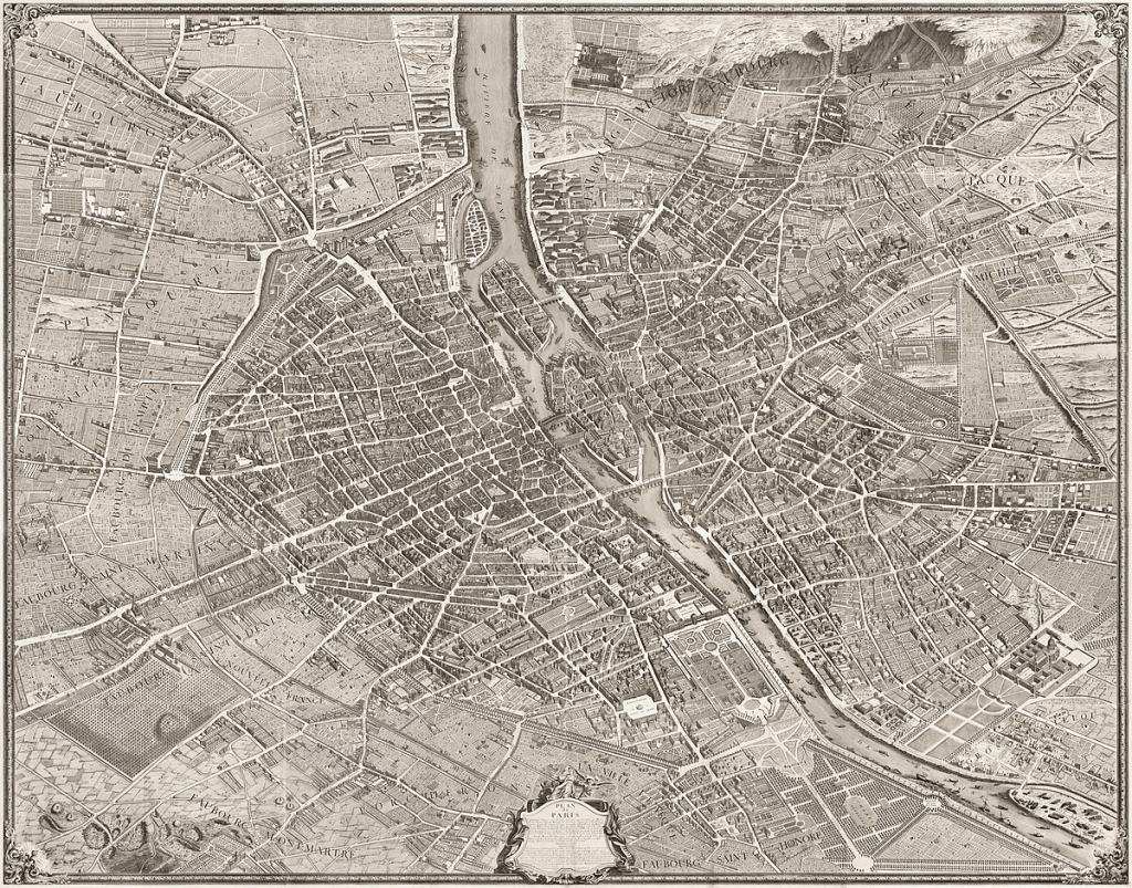
FR: Le 15 janvier, Vincent nous a donné une présentation au sujet du plan de Turgot. Il a été réalisé par Louis Bretez de l’Académie de peinture et de sculpture, à la demande du prévôt des marchands Michel Étienne Turgot aux années 1730s. Il est composé de 20 feuilles et il mesure 3.2m x 2.5m. Il répresente Paris en perspective isometrique (pas vue à vol d’oiseau, mais un peu diagonal), et comme quelques autres cartes du moment, le nord est à gauche. C’est pour ça que le plan Turgot n’est pas la carte la plus pratique. Mais Turgot a commandé un portrait de Paris (pas une simple carte) pour promouvoir l’image de Paris et démontrer sa beauté au monde. Donc, son orientation et son angle permettent de représenter tout Paris, de la cathédrale de Notre-Dame à des coins sans nom, en grand détail.
EN: On January 15, Vincent gave us a presentation about the Turgot map of Paris. It was created by Louis Bretez of the Academy of Painting and Sculpture at the request of the merchant provost Michel Étienne Turgot in the 1730s. It consists of 20 sheets and measures 3.2m x 2.5m. It depicts Paris in isometric perspective (not a bird’s-eye view but slightly diagonal), and like some other maps of the time, north is on the left. For this reason, the Turgot map is not the most practical map. However, Turgot commissioned a portrait of Paris (not just a mere map) to promote the image of Paris and showcase its beauty to the world. Thus, its orientation and angle allow for the depiction of all of Paris, from Notre-Dame Cathedral to unnamed corners, in great detail.
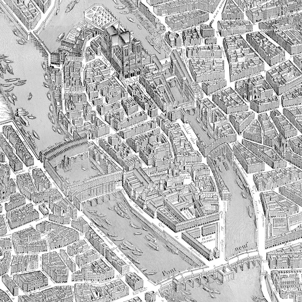
FR: Cette vue rapprochée de l’Île de la cité dans le plan Turgot nous permet d’apprécier le niveau de détail du plan. Le plan de Turgot nous permet d’observer comment Paris a changé depuis le 18ème siècle. On peut reconnaître la cathédrale Notre-Dame en haut de l’image et la Place Dauphine et le Pont neuf en bas de l’image. Mais il dépeint aussi des bâtiments qui n’existent plus, comme le Pont Notre-Dame (partie gauche de l’image) et l’Hôtel Dieu (devant Notre-Dame). Ensuite, je vais présenter quelques endroits dans le plan de Turgot que Vincent nous a présenté.
EN: This close-up view of Île de la Cité in the Turgot map allows us to appreciate the level of detail in the plan. The Turgot map provides an opportunity to observe how Paris has changed since the 18th century. We can recognize Notre-Dame Cathedral at the top of the image, as well as Place Dauphine and Pont Neuf at the bottom. However, it also depicts buildings that no longer exist, such as the Pont Notre-Dame (on the left side of the image) and the Hôtel-Dieu (in front of Notre-Dame). Next, I will present some locations in the Turgot map that Vincent showed us.
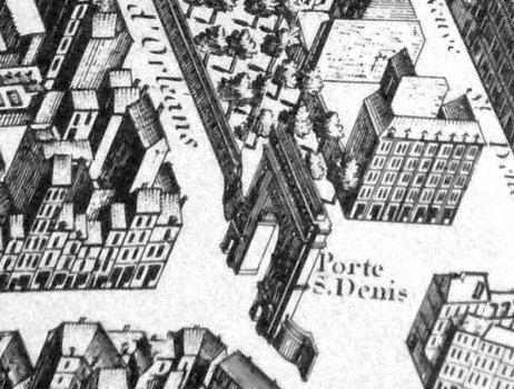
EN: The Porte Saint-Denis in the Turgot map. Paris has grown significantly since the 18th century, but it remains a symbolic gateway to the city.
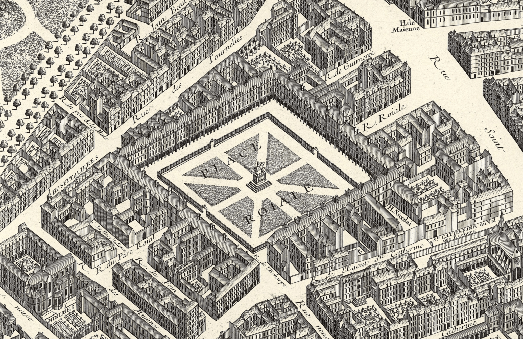
EN: The Place Royale, or Place des Vosges, in the Turgot map. Its construction was inspired by Spanish plazas and it was a common meeting place for Parisians.
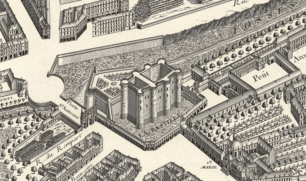
EN: The Bastille in the Turgot map. Initially, it was a fortress, but at the time, it served as a prison.
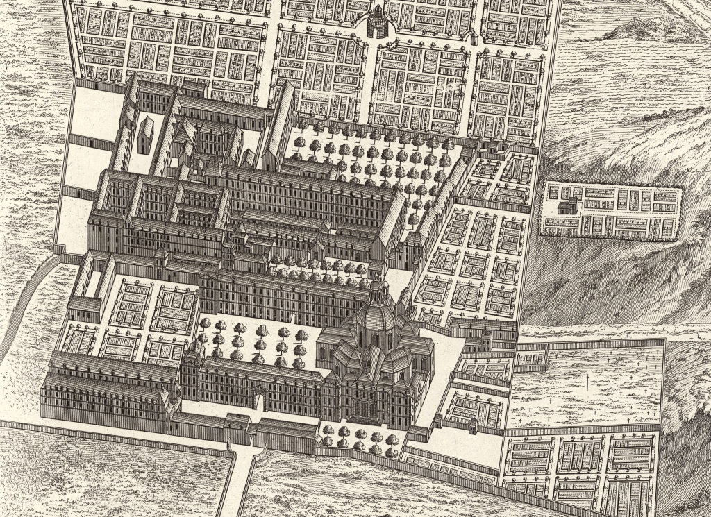
EN: La Salpêtrière in the Turgot map. At the time, it housed the poor and prostitutes. Today, it is a hospital.
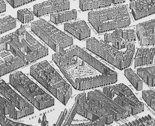
EN: The Cemetery of the Innocents in the Turgot map. It no longer exists, as many cemeteries were emptied (because they were thought to cause diseases), and the bodies were moved to the former quarries, which are now known as the Catacombs of Paris.

Leave a comment